
Nature · Dolomiti di Brenta
Cima Brenta
It is the highest peak of the Dolomiti di Brenta, not the Tosa.
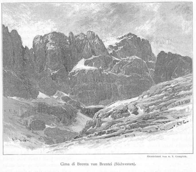

Cima Brenta reaches 3,151 metres and is the highest summit of the Dolomiti di Brenta: it stands a few metres above the better-known Cima Tosa. It is the culminating point of the massif that forms the central part of the group, between the Tosa to the south and the Grostè to the north, and it lies on the main ridge, which forms its north and south crests.
From the summit the mighty west crest also branches off; at 3,122 metres it forms a subsidiary peak and divides there: towards the west it continues as far as cima Mandron and the two Punte di Campiglio, with the great walls looming over the rifugio Brentei; towards the north-west it forms the fifteen Torri di Kiene and ends in the Punta Massari, above the rifugio Tuckett. Between the two crests lies the vedretta di Brenta superiore. To the east a great yellowish wall drops for eight hundred metres onto the val Perse, cut across at the top by the cengia Garbari, where the stretch of the Via delle Bocchette called Bocchette Alte passes.
The first ascent dates from August 1871 and was made by the Englishmen Douglas William Freshfield and Charles Comyns Tucker with the guide François Devouassoud of Chamonix, climbing from the west by the vedretta di Brenta superiore. That route is rarely followed today: the normal route climbs from the north and then from the east, along the via delle Bocchette from the bocca di Tuckett to the cengia Garbari.
- Height
- 3,151 m
- East face
- 800 m above the val Perse
- First ascent
- August 1871
- Group
- Dolomiti di Brenta
- Prominence
- 1,501 m
Trails that pass through here
- O305AVia ferrata delle Bocchette alteEEA-D3.7 kmabout 200 m away
- O303Via ferrata "Osvaldo Orsi"EEA-PD6.9 kmabout 450 m away
From the register of alpine trails of the Autonomous Province of Trento. © SAT.